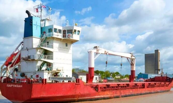
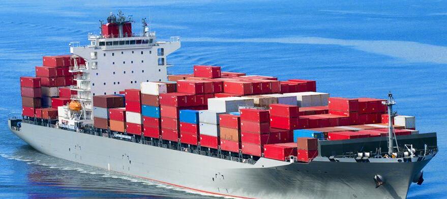
该公司否认从事任何违反制裁的活动。该公司的几艘船已经在韩国滞港一个多月,而另一艘船停在南通,无法向当地船厂支付修船费用。
为走出目前陷入的困境,Gudzon高官已经向俄罗斯政府寻求帮助,但没有迹象表明该公司船队短时间内可以再从事国际贸易活动。
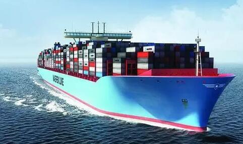
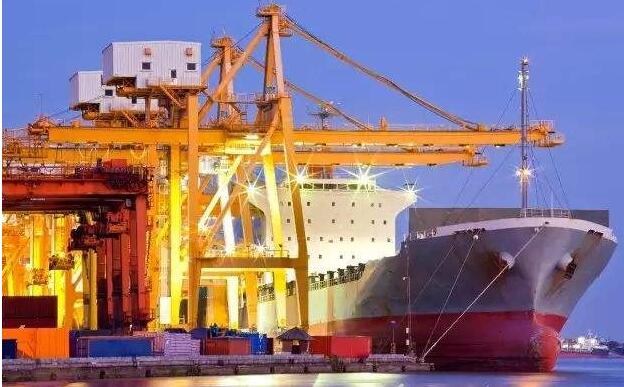
全球最大集运公司马士基航运日前宣布,由于古巴经济制裁解除,该公司将恢复首条爱尔兰-古巴直航服务。
马士基航运表示,该航线已于4月22日恢复运行,首航港口为古巴马瑞尔港。该航线将作为马士基CRX-南行航线的一部分,提供爱尔兰科克港至拉丁美洲其他港口的集运服务。
爱尔兰海事发展办公室主任Liam Lacey表示,马士基航运此次恢复古巴贸易业务,并选择爱尔兰市场作为首批贸易市场作为其强劲支持,显示爱尔兰市场进出口贸易仍然存在进一步增长潜力。
据IMDO数据显示,新科克-古巴航线将成为市场上最快的中转运输航线,提供连接古巴圣地亚哥哈瓦那的周班支线运输服务。马士基航运表示,在过去的几年里,古巴集装箱运输市场持续以年均10-15%的速度增长。
作为首批在古巴经济制裁解除后的积极参与者之一,该公司相信新服务将支持马瑞尔经济特区发展,从而成为古巴主要发展动力。
以海运为镜,看全球性物流供应链与经贸系统之复杂性
--《港航大数据驱动的全球集装箱海运网络监测与决策技术》课题答辩节选
海运是那么具体,装装卸卸、搬搬运运,不是劳动密集,就是机器密集,或者智能密集。然而,所看不到的是这种密集背后所形成的人与机器的新的社会性系统,并在时空的耦合下绽放复杂性;在这个球体上,秀一道道彩虹。
这个课题是多学科方法与技术的综合应用,包括:海运经济与管理、数据科学与网络科学、物联网与信息科学、数学建模与算法设计等等。
这个研究体现三个方面的背景与依据。一,包括港口、船舶、航行、经济地理和交通物流的各种数据采集技术日趋成熟,尤其是随着物联网和大数据技术发展,逐渐具备可获取的数据源和数据供应通道。二,在航运物流企业管理的基础上,行业与国家供应链在复杂的国内外经贸与政治环境中都逐渐显现其重要性,在上海建设航运中心和科创中心等背景下尤其显著。三,一带一路倡议等重大国家需求催化下,相应的地区性与全球性研究要求以体现实务的货物和金融流为基础。
研究进展体现两个方面,一是基础研究,二是应用研究。
基础研究围绕三方面的内容展开。一,全球海运网络与箱流网络的建模与分析。包括:船港数据驱动的全球海运网络;叠加船舶位置智能的全球海运动态网络;基于港口和船舶动态数据的流量判决与箱流网络构造。
二,集装箱监测系统驱动的箱流过程监管技术。包括:物联网背景下集装箱监测系统和全球互联技术;集成OD数据的集装箱流动状态判决;基于箱流过程监管的运途、运力与港口资源绩效。
三,箱流时空网络提取与集装箱运力决策技术。包括:基于运力动态数据时空叠加的网络流;基于复杂网络的集装箱箱流时空网络演变统计特征与模式挖掘;运力重部署的不确定规划及其计算实验技术。
港航大数据系统以港航和海运数据为主体,并耦合经济地理等其他领域数据,形成数据系统的层次和开放性体系。港口是直接体现空间尺度的实体,往下看是码头和泊位等具体作业设施,往上看是港口城市等多层次经济实体。海运系统具体的体现为船舶流、航线、货物流和贸易流。体现空间关系和时间上演变的数据系统,数据逻辑关系的提炼和抽象是关键,网络建模是各类分析的基础。对于集装箱运输而言,货物、集装箱、船舶形成货物流的多个层次与尺度。耦合船舶流和集装箱流,便于海运网络精细化分析与决策。
全球海运网络具有多样的视角与层次。通过建立全球性港口网络,分析港口的连通性与演变,考虑港口在全球港口网络中的地位,对港口进行多维评价,可以发现港口所在的集群与所处的发展阶段,由此体现发展模式的参照与风险。从综合十六个维度的港口聚类分析来看,和墨尔本十分像的港口很多,和上海港八分像的港口都没有,这是机会也是风险。
微观的海运网络体现为集装箱物联网,集装箱是密集的海运物流设施,随着RFID、无线传感器网络、物联网等技术的应用与发展,集装箱联网趋势凸显。以冷藏箱等高附加值集装箱管理为例,其活动范围在港口网络之上,一方面深入腹地,另一方面深入跨境物流。因此,集装箱物联网数据的建模、存储与传输都要求进行自适应设计,提高效率和降低成本。
集装箱流与船舶流的耦合在微观、中观和宏观为不同层次的管理与决策提供了新的工具。以中越之间的海运货物贸易为例,受到物理热力学对流网络的启发,建立了体现中越港口之间平流与扩散的模型,分析海运对流网络的演变和决策机会。例如,长三角逐步纵深地参与到中越贸易中,中国港口的参与具有分布性;而越南港口的参与较为集中,隐含了港口设施和航线网络调整与优化的机会。
在趋于宏观的层面,通过网络与子网络的嵌入与交互模型及其分析,研究海运网络中不同经济实体之间的复杂关系。例如,越南海运网络置于一带一路三大海运集群之间,上接中国,下有新加坡,深度连接欧洲。越南发展强化自身海运网络的机会很小,融入这个铁三角是合适选择。即便如此,越南自身海运网络,依然可以考虑这种嵌入性进行调整与优化,区域性的枢纽港发展对于越南制造的发展具有积极意义。
应用研究进展体现在三个层次,物流物联网,物流经济地理,海上丝绸之路。
一,物流物联网。主要涉及船舶轨迹网络,集装箱物联网系统,集装箱物联网决策。轨迹体现实际集装流与船舶流,轨迹是海运网络的微观体现。通过轨迹与港口设施的耦合分析,得到动态的港口船舶流与海运网络,港口之间因为船舶流而形成动态耦合。由此,在一定程度上为港口流动态分析与预测提供依据。集装箱物联网是更精细的分析尺度,港区内与船舶上的集装箱互联形成局部网络,广域互联体现货物流动。有效的通信网络决策是这个网络全球性连通的关键。
二,物流经济地理。主要涉及港口基础设施影响,国家性海运系统,全球性海运系统。当微观的设施与流通数据耦合起来,就能够形成不同层次与尺度的网络,在一定程度上对设施与流通后面的复杂性进行建模与分析。在海运背景下,港口是最直接的分析对象,例如在此基础上,分析了上海港、宁波舟山港、香港、釜山、仁荷、新加坡、墨尔本等港口,及其与中国的关系;以港口为基本对象,可以分析国家或区域之间的互动,研究了美国、韩国、日本、新加坡、越南、等国家与经济体的海运系统,及其与中国的关系。在全球海运网络背景下,港口、国家、地区,都是对海运网络的一个新的划分,它们之间的交互可以体现经济、贸易、物流、全球供应链,乃至于环境与政治联系。
三,海上丝绸之路。主要涉及中国海运与无水港,一带一路海运与陆运,一带一路海运投资。海上丝绸之路嵌入在全球海运网络中,可以分析其独立性,但不能孤立的研究。首先,中国自身就蕴含了"一带"与"一路"的互动,通过无水港等物流与贸易设施对两者的连通,是区域协调之关键。以区域经济耦合综合运输网络的研究能够发现促成这种协调的脉络。在大数据驱动的全球海运网络背景下,通过网络复杂性、计算实验、联邦式建模等研究手段,亚欧大陆、中巴经济走廊、南海、对外投资与贸易、全球性海运通道,等等,都能"照"出新的格局,涌现出新的联系。
以上的研究,最基础的来说,涉及一个以港航物流数据系统,以及在此基础上的数据、网络和复杂系统的建模与分析的方法与技术实现。一个体现全球性的数据系统,就如一面镜子,经济、贸易、政治与国际关系等等,低头时都能看到自己的影子,抬头时,都在形成与改变我们看待其系统性与复杂性的观念与思路,从而形成新的做法与技术实现、语言与惯性。
Gudzon Shipping, based in Vladivostok, Russia, is on the verge of bankruptcy after being found guilty of conducting a ship-to-ship barter deal with a korean-korean entity and having six ships blacklisted by the United States.
The company denies any sanctions violations. Several of the company's ships have been in South Korea for more than a month, while the other is in nantong and unable to pay the local shipyard for repairs.
Gudzon officials have asked the Russian government for help in getting out of its current difficulties, but there is no sign that the company's fleet will be able to trade internationally any time soon.
Maersk line, the world's largest container line, said it would resume its first direct irish-cuban service following the lifting of economic sanctions against Cuba.
Maersk line said the route had resumed operations on April 22, with the port of mariel in Cuba as the first port of departure. The route will be part of the maersk crx-southbound route and will serve as a hub between cork, Ireland, and other Latin American ports.
Liam Lacey, director of the Irish maritime development office, said the resumption of maersk line's business in Cuba and the selection of the Irish market as the first market for its strong support showed the potential for further growth in the Irish market.
According to IMDO data, the new coke-cuba route will be the fastest transit route on the market, providing weekly feeder service to Santiago Havana, Cuba. Maersk line says the Cuban container market has been growing at an average annual rate of 10-15% for the past few years.
As one of the first active participants after the lifting of economic sanctions in Cuba, the company believes that the new service will support the development of the mariel special economic zone and thus become a major driver of development in Cuba.
Look at the complexity of global logistics supply chain and economic and trade system in the mirror of shipping
-- excerpt from the defense of "big data-driven global container shipping network monitoring and decision-making technology of ports and airlines"
Shipping is so specific, loading, unloading, moving, handling and transportation, is not labor intensive, is machine intensive, or intelligence intensive. What is not seen, however, is the new social system of man and machine that forms behind this density and blooms complexity under the coupling of space and time; On this globe, there are many rainbows.
This topic is a comprehensive application of multidisciplinary methods and technologies, including: maritime economy and management, data science and network science, Internet of things and information science, mathematical modeling and algorithm design, etc.
This research embodies the background and basis of three aspects. 1. Various data collection technologies, including ports, ships, navigation, economic geography and transportation logistics, are becoming increasingly mature. Especially with the development of the Internet of things and big data technology, data sources and data supply channels are gradually available. Second, on the basis of the management of shipping and logistics enterprises, the industry and national supply chain are gradually showing their importance in the complex economic, trade and political environment at home and abroad, especially in the context of the construction of shipping center and scientific and technological innovation center in Shanghai. Third, the One Belt And One Road initiative and other major national demand catalyzed, the corresponding regional and global research requirements are based on the practical goods and financial flows.
The research progress reflects two aspects, one is the basic research, the other is the applied research.
Basic research is carried out in three aspects. I. modeling and analysis of global shipping network and box flow network. Include: global shipping network driven by ship port data; Global maritime dynamic network with superimposed ship position intelligence; Flow judgment and box flow network construction based on port and ship dynamic data.
Ii. Container flow process monitoring technology driven by container monitoring system. Including: container monitoring system and global interconnection technology in the context of Internet of things; Container flow status judgment with OD data integration; The performance of transport route, capacity and port resources based on box flow process supervision.
Third, the container flow space-time network extraction and container capacity decision technology. It includes: network flow based on spatial and temporal superposition of dynamic data; On the basis of complex network, the statistical characteristics and patterns of the evolution of the spatial and temporal network of container flow are explored. The uncertain planning of redeployment of capacity and its calculation experiment technique.
The port and shipping big data system takes port and shipping data as the main body, coupled with data from other fields such as economic geography, and forms a hierarchical and open system of the data system. Port is an entity that directly reflects the spatial scale. It looks down to the specific operating facilities such as docks and berths, and up to the multi-level economic entities such as port cities. The shipping system is embodied in ship flow, route, cargo flow and trade flow. It is a data system that reflects the evolution of spatial relations and time. The extraction and abstraction of data logic relations is the key. Network modeling is the foundation of all kinds of analysis. For container transportation, goods, containers and ships form multiple levels and scales of cargo flow. The coupling of ship flow and container flow facilitates the refined analysis and decision-making of maritime transportation network.

The global shipping network has a variety of perspectives and layers. Through the establishment of a global port network, the connectivity and evolution of ports are analyzed, the status of ports in the global port network is considered, and the multi-dimensional evaluation of ports is carried out, the cluster and development stage of ports can be found, and the reference and risk of development mode can be reflected. From the comprehensive port cluster analysis of 16 dimensions, it can be seen that there are many ports that are very similar to Melbourne, but not those that are eight times like Shanghai. This is both an opportunity and a risk.
The microscopic shipping network is embodied in the container Internet of things, which is a dense maritime logistics facility. With the application and development of RFID, wireless sensor network, Internet of things and other technologies, the trend of container networking has become prominent. Taking the management of high-value-added containers such as refrigerated containers as an example, its activities range in the port network, on the one hand, deep into the hinterland, on the other hand, deep into cross-border logistics. Therefore, the modeling, storage and transmission of container iot data require adaptive design to improve efficiency and reduce costs.
The coupling of container flow and ship flow provides a new tool for different levels of management and decision in micro, medium and macro. Taking the maritime trade of goods between China and Vietnam as an example, the model of advection and diffusion between Chinese and Vietnamese ports is established, which is inspired by the convection network of physics and thermodynamics. For example, the Yangtze river delta gradually participates in the sino-vietnamese trade in depth, and the participation of Chinese ports is distributed. The participation of Vietnamese ports is concentrated, which implies the opportunity of port facilities and route network adjustment and optimization.
At the macroscopic level, the complex relationship between different economic entities in maritime transportation network is studied by the embedding and interaction model of network and sub-network and its analysis. For example, Vietnam's shipping network is placed between three major shipping clusters in One Belt And One Road, with China at the top, Singapore at the bottom, and deep connections to Europe. Vietnam has little chance of developing and strengthening its own maritime network. Even so, Vietnam's own shipping network can still be adjusted and optimized by considering such embeddability. The development of regional hub ports is of positive significance for the development of Vietnamese manufacturing.
The progress of applied research is reflected in three levels: logistics Internet of things, logistics economic geography and maritime silk road.
First, logistics Internet of things. It mainly involves ship track network, container Internet of things system, container Internet of things decision. The trajectory reflects the actual container flow and ship flow, and the trajectory is the microscopic embodiment of the shipping network. Through the coupling analysis of track and port facilities, the dynamic port ship flow and shipping network are obtained. Thus, to a certain extent, it provides a basis for the dynamic analysis and prediction of port flow. The container Internet of things (iot) is a more detailed analytical scale. The interconnection between the port area and the containers on ships forms a local network, and the wide-area interconnection reflects the flow of goods. Effective communication network decision making is the key to the global connectivity of this network.
Second, logistics economic geography. Mainly involves the port infrastructure influence, the national maritime transport system, the global maritime transport system. When the microscopic facilities are coupled with the flow data, the network of different levels and scales can be formed, and the complexity behind the facilities and flows can be modeled and analyzed to a certain extent. In the context of maritime transport, ports are the most direct analysis objects. For example, on this basis, ports such as Shanghai port, ningbo zhoushan port, Hong Kong, busan, renhe, Singapore and Melbourne and their relations with China are analyzed. Taking ports as the basic object, we can analyze the interaction between countries or regions, and study the shipping systems of the United States, South Korea, Japan, Singapore, Vietnam and other countries and economies, and their relations with China. In the context of the global shipping network, ports, countries and regions are a new division of the shipping network, and their interactions can reflect the economy, trade, logistics, global supply chain, and even the environmental and political links.
Third, the maritime silk road. It mainly involves China's maritime transportation and waterless port, One Belt And One Road maritime transportation and land transportation, and the investment of one belt and one road maritime transportation. The maritime silk road is embedded in the global shipping network, and its independence can be analyzed, but not studied in isolation. First of all, China itself contains the "one belt" and "one road" interaction, through the waterless port and other logistics and trade facilities to connect the two, is the key to regional coordination. The research of integrated transport network coupled with regional economy can find the context to promote such coordination. In the context of the global shipping network driven by big data, new patterns and connections can emerge in Eurasia, the china-pakistan economic corridor, the south China sea, foreign investment and trade, global shipping lanes, etc., through network complexity, computational experiments, and federal modeling.
The above research, in the most basic terms, involves a data system of port and waterway logistics, and the method and technical realization of modeling and analysis of data, network and complex system based on this. A global data system is just like a mirror: economy, trade, politics, international relations, etc. When we look down, we can see our own shadow; when we look up, we are all forming and changing our ideas and thoughts on its systematicity and complexity, thus forming new practices and technological realization, language and inertia.